POI markers & popups
Click any marker, or a numbered cluster to zoom in first, and its popup opens. At the top is the name, with a brand icon if OnRouteMap recognizes the chain, for example a specific supermarket or fuel brand. Below that, if OpenStreetMap has anything worth flagging for this particular spot, a short dynamic note shows up (more on that below), not every POI has one.
Next comes the opening-hours line, pulled from OpenStreetMap: "Open until…", "Open from … to …", "24/7 open", "Closed today", or "Opening hours unknown" if the data just isn't there. Tap the small info icon next to it to reveal a credit to OpenStreetMap and a Report error link, which opens an OpenStreetMap note pre-filled at that exact location, so you or anyone else can go fix it.
After that comes the plain-text type ("Fuel station", for instance), then, on route maps, the route kilometer both from the start and to the finish, e.g. 90.4 km → 21.4 km. Tap the info icon next to it to spell out "from start"/"to finish" as labels instead of just icons. Point-search maps skip this line entirely, since there's no route to measure kilometers along. At the bottom sits a row of action links: Show on Google Maps, Get details (covered below), and a star to add the POI to favorites.
Distance
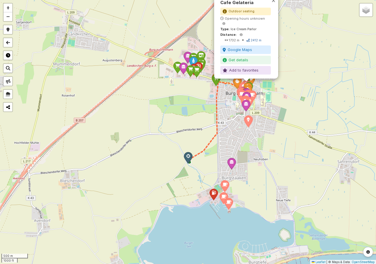
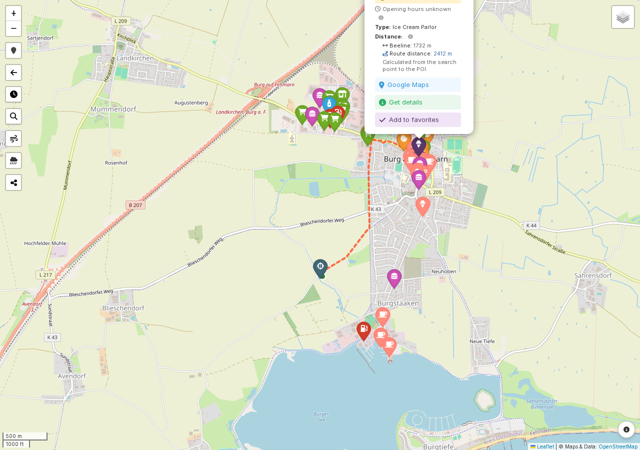
Every POI shows two distance values under Distance: a straight-line Beeline figure that's available immediately, and a Route distance that loads a moment later, the actual cycling-route distance from the route (or, on point-search maps, from your search point) to the POI. Tap the icon next to Distance to see both spelled out with labels, stacked for easier reading, along with a short note on how the route distance is worked out.
On route maps, the route distance starts from whichever point on your route sits closest to the POI as the crow flies, which isn't always the most sensible place to actually turn off, so a small green marker appears on the map at that starting point once the value has loaded; on point-search maps, it naturally starts right at your search point instead. Either way, the calculated path is drawn as a dashed line, and both stay on the map, even while you pan or zoom, until you open a different POI's popup.
If the route distance doesn't show up at all, only the beeline figure remains. That happens occasionally: a busy routing server, no rideable path found, or, on a point-search map created before this feature existed, no stored search point to calculate from. Either way, it's nothing to worry about, the beeline distance is still accurate.
Dynamic POI notes
Beyond the fields above, OnRouteMap reads a handful of OpenStreetMap tags per POI and turns anything practically useful into a short note. For water sources, that might be "Drinking water quality confirmed.", "No drinking water!", "Boil water before drinking!", or "Drinking water at your own risk." Elsewhere you might see "Toilets available.", "Shower available.", "Fee required." (or "Free of charge." / "Donation welcome."), "Reservation required." (or "Reservation recommended."), or smaller ones like a power supply, a bicycle pump, WiFi, outdoor seating, self-service, or "No tents allowed."
Shelters get their specific type spelled out, e.g. "Basic hut with sleeping accommodation." or "Open lean-to shelter.", and access restrictions show up as "Private, no public access.", "Customers only.", or "Permit required."
Cemeteries and graveyards always carry a reminder to check drinking water quality on site, since a tap there isn't guaranteed to be drinkable everywhere it's listed. Wilderness huts get flagged as unstaffed with a note to check access restrictions.
As with opening hours, this comes straight from OpenStreetMap and can be incomplete or out of date. Treat it as a useful pointer rather than a guarantee, and use Report error if something's wrong.
Get details
Get details looks up the POI on Google Maps and replaces the popup content with its full address, star rating and review count (with a small info toggle crediting Google as the source), full weekly opening hours with today's line highlighted, and a link to show it on Google Maps.
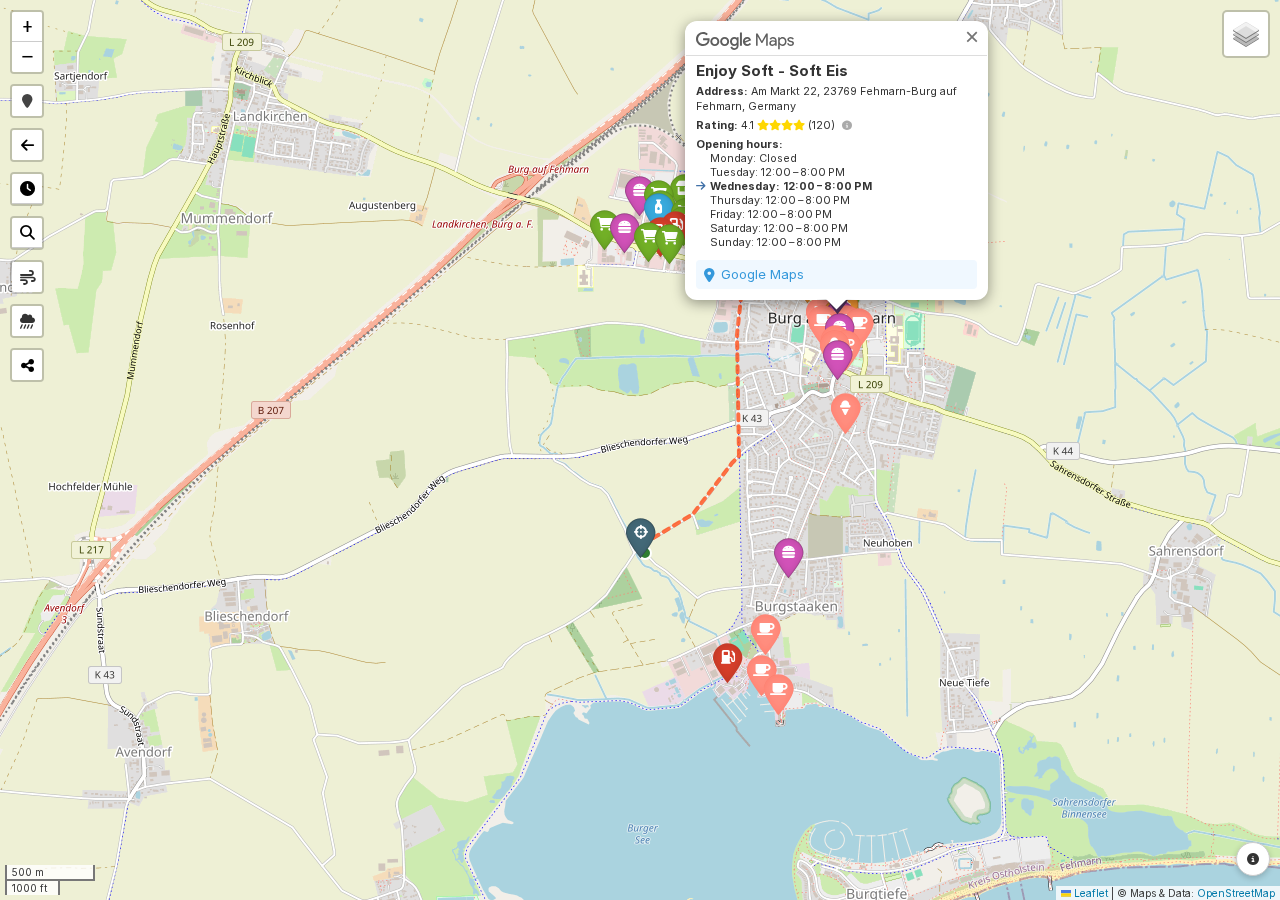
If Google doesn't have a matching entry nearby, you'll just see a short "no data available" message instead, which is normal for smaller or unnamed POIs. For a handful of simple, typically unnamed POI types where a Google listing rarely exists or helps, Get details is disabled outright rather than running a lookup that would come back empty. This lookup counts against a shared rate limit (see Limits & troubleshooting), so OnRouteMap only fetches it when you actually click Get details, never for every marker up front.
Note
Every 10th time you use Get details, a small reminder pops up noting that each lookup costs money (the Google Places API isn't free), with a link to donate and a checkbox to dismiss it for good if you've already given something.